I wasn’t looking for a mountain.
I wasn’t looking for a waterfall, a lighthouse, or anything else that was going to require getting up at some ungodly hour and driving halfway across Maine.
I just wanted to walk in the woods.
Preferably somewhere that wasn’t going to make my hip file a formal complaint.
That’s how I ended up at Piper Stream Preserve in Northport, a small Coastal Mountains Land Trust preserve I’d driven past plenty of times without ever really knowing what was back there.
I almost didn’t bother bringing the camera.
Almost.
Apparently I’m no longer capable of going for a simple walk without carrying several pounds of Nikon equipment just in case a fern does something interesting.
Trail Snapshot
📍 Location: Prescott Hill Road, Northport, Maine
🥾 Difficulty: Easy. Nearly flat overall, but this is still a natural woodland trail with roots, rocks and uneven footing.
📏 Distance: Short, but there’s a wrinkle here. Coastal Mountains Land Trust’s published information gives conflicting trail lengths, and my own walk included a short wander beyond the last blue markers. My Gaia recording finished at 0.84 mile. I’d treat Piper Stream as a short woodland walk rather than plan around an exact mileage.
⏱ My Visit: 30:49 total, including stops and my brief attempt to determine whether the trail actually wanted me to keep going.
⬆️ Recorded Ascent: 24 feet according to Gaia. Basically, my coffee probably experienced more elevation change that morning.
🚙 Parking: Small roadside pull-off. I estimated room for maybe three compact cars. The sign is obvious. Backing into traffic deserves a little attention.
🌲 Trail Surface: Natural forest floor with roots, rocks, bog bridges and a bridge over Piper Stream.
🐜 Conditions on September 7: Dry, low stream flow, a nice late-summer breeze and somehow no bugs.
💡 Good to Know: The blue blazes were easy to follow for most of my walk. The far end was considerably less interested in explaining itself.
Into the Woods
The parking area isn’t much.
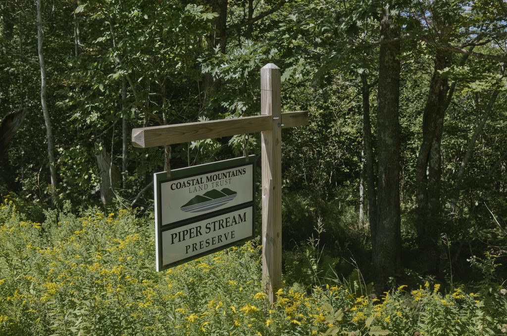
There’s a large Piper Stream Preserve sign beside Prescott Hill Road and a little pull-off that looked like it would hold maybe three compact cars if everyone parked like functioning adults.
I pulled in at almost exactly the same time as another guy.
Perfect.
I’d picked a tiny preserve for a quiet walk through the woods and somehow managed to synchronize my arrival with the only other person I would see the entire time.
Fortunately, we went our separate ways quickly enough, and within a few minutes I was alone.
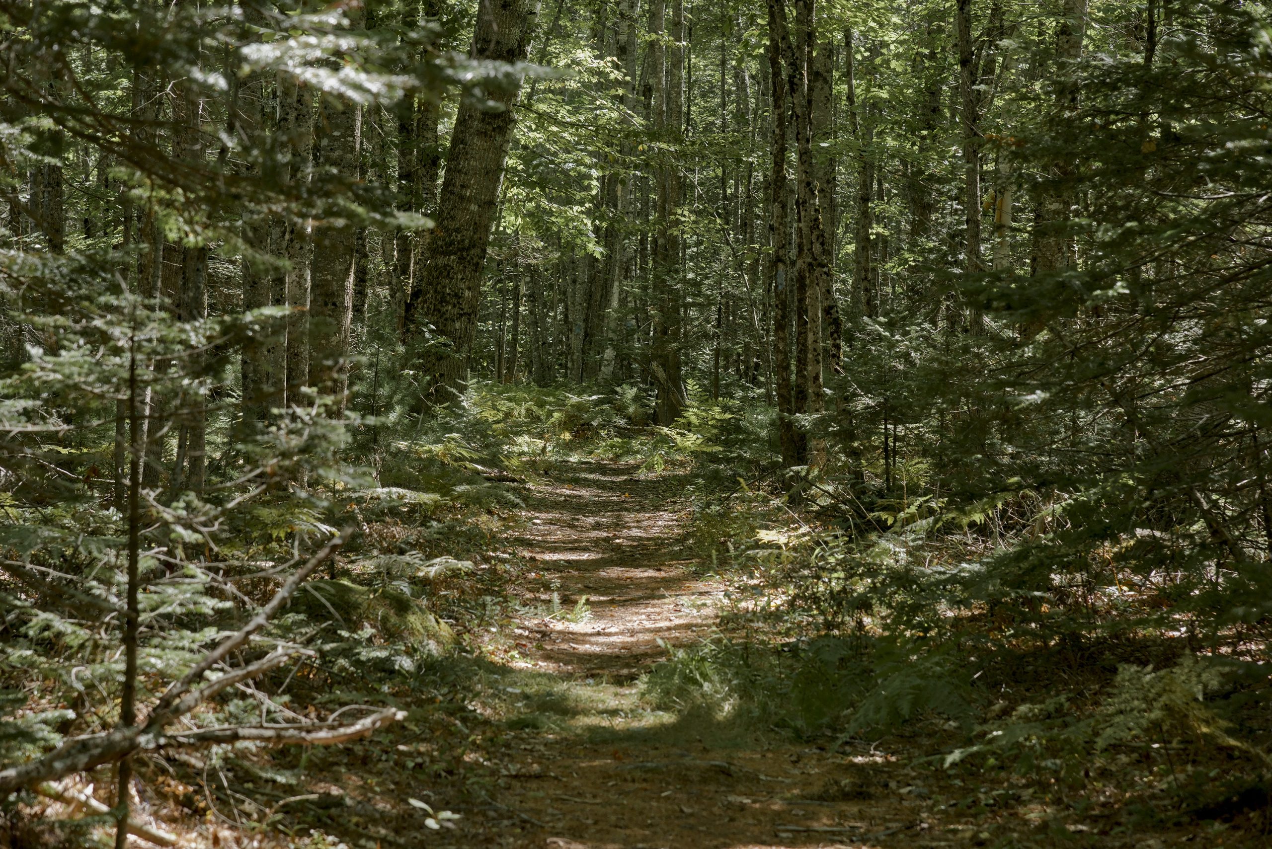
The trail settles into the woods almost immediately.
There isn’t much elevation here. It’s mostly an easy dirt footpath through dense forest, although “easy” doesn’t mean you’re walking around Walmart. There are roots, rocks and uneven sections underfoot, along with a few bog bridges.
Normally none of that would be worth mentioning.
Unfortunately, my ankle and I were still having a disagreement.
I’d twisted it about a month earlier. Regular walking was fine, but every time my foot landed at a slightly different angle, the ankle sent a helpful little reminder that it had not forgotten.
My hip, for once, remained suspiciously quiet.
I’ll take the win.
Nothing Dramatic Happened
That’s probably the best description of Piper Stream Preserve.
Nothing dramatic happened.
There wasn’t some enormous view pulling me farther down the trail. No summit. No big reveal waiting around the next corner.
And after a little while, I stopped expecting one.
I started noticing the woods instead.
The trail moved between spruce, fir and hardwoods with ferns covering much of the forest floor. Sunlight came through the canopy in patches, catching one section of trail and leaving the next in shadow.
It was quiet.
The stream was low but still running. There was a nice breeze moving through the trees. And somehow, on a September walk through the Maine woods, I encountered no bugs.
None.
I’m not entirely convinced this wasn’t some sort of administrative error.
The Old Dam
A little farther along, there’s still evidence that these woods weren’t always quite so quiet.
Beside the stream are the remains of an old dam connected to the stave mill that once operated here.
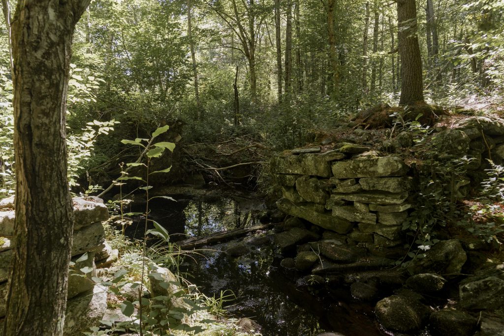
It’s easy to walk through a place like this and think you’re looking at untouched woods. Then you find a pile of carefully stacked stone beside a stream and realize somebody was using this water for an entirely different purpose long before you showed up carrying a Nikon and complaining about your ankle.
A little farther up the trail, I found something considerably less historic.
Just a bench sitting among the trees.
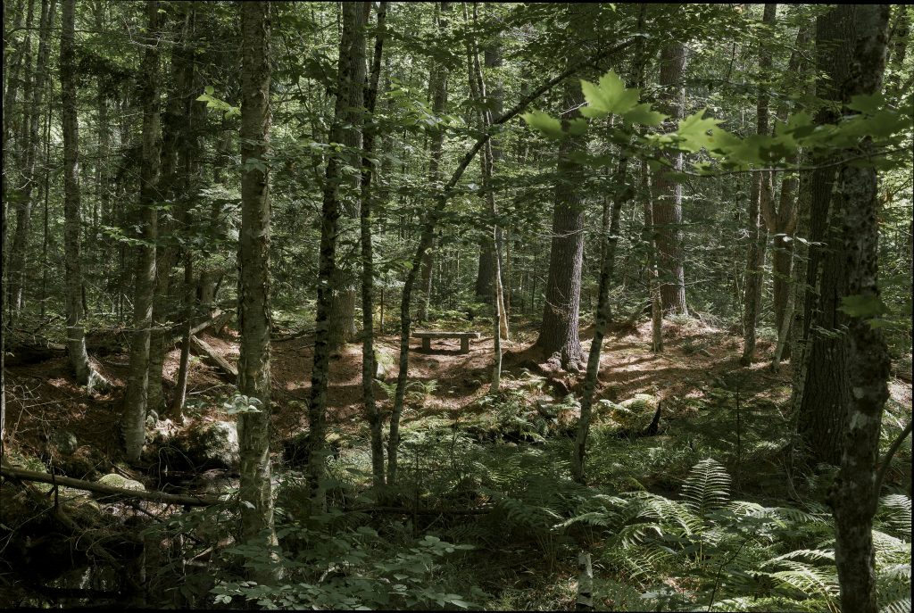
No overlook.
No mountain.
No interpretive sign explaining why this particular spot deserves your attention.
Somebody just decided this was a good place to sit for a while.
I think they were right.
Naturally, I took a picture of it and kept walking.
Piper Stream
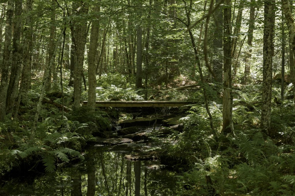
Eventually the trail reaches the stream and a small wooden bridge.
This isn’t Moxie Falls.
Nobody is going to stand here contemplating the overwhelming power of nature while mist rises dramatically around them.
It’s a little stream moving quietly through the woods.
And it works.
The ferns crowd the banks, trees close in around the water, and the bridge gives you just enough of a clearing to stop and look around.
Photographically, that’s probably what interested me most about this place.
Piper Stream isn’t handing you an obvious hero photograph. You have to look smaller.
Light on the forest floor. Ferns. Moss. Roots. Water moving between rocks. Mushrooms when they’re around. Leaves beginning to change. All the little woodland stuff I have a bad habit of walking past while looking for something more impressive.
This feels like a place where the photographs could change completely from one visit to the next.
Where the Hell Does This Trail End?
Most of the trail was well marked with blue blazes.
Then it wasn’t.
Near what I assumed was the far end, I stopped seeing blue markers. There was still something resembling a footpath continuing into the woods, though.
So naturally I followed it.
Because apparently “there are no more trail markers” isn’t sufficiently clear communication for me.
The path continued a short distance before petering out.
I looked around for another blue blaze.
Nothing.
I went a little farther.
Still nothing.
At that point I was pretty sure I’d already reached the end of the maintained trail and was now just wandering through the woods hoping somebody would eventually explain the situation.
Nobody did.
I turned around.
The exact maintained endpoint is one thing I’d like to confirm before giving anybody definitive directions. But based on my experience that day, if you’ve been following the blue blazes and suddenly can’t find another one near the far end, don’t automatically assume you’ve missed something.
You might simply be there.
The Walk Back
Once I turned around, I wasn’t really looking for anything anymore.
I’d already seen the old dam, ignored a perfectly good bench, found the stream and bridge, and briefly wandered beyond what was probably the end of the trail because apparently blue blazes disappearing wasn’t enough of a hint.
By the time I got back to the Jeep, Gaia showed 0.84 mile. I’d been out there a little over half an hour.
No dramatic landscape.
No portfolio photograph.
No great physical accomplishment.
Just a short walk through quiet woods about ten minutes from home, with a sore ankle, a camera that probably wasn’t necessary, one confused trail ending and the miraculous absence of mosquitoes.
I’d go back.
Next time, maybe I’ll even sit on the damn bench.